The start and finish locations for the Yukon River Trail Marathon this year are in Shipyards Park. This change is to accommodate construction planned for Rotary Peace Park this summer.
The change to Shipyards Park means that the course will be slightly longer for 2024.
We have updated our map to show the longer course for 2024.
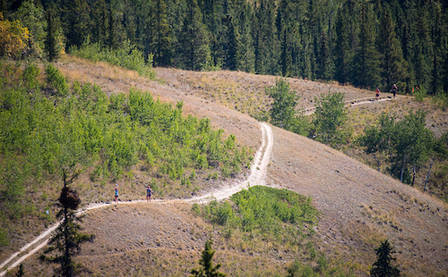
Here is the typical (not 2024) Trail Map. Note that this map is not accurate for 2024.
Course Overview
For 2024, the race begins and ends in Shipyards Park. For much of the course, you will be running alongside or above the Yukon River or one of a few small pothole lakes. The trail, though well used, is worn so watch out for tree roots in many spots. There is significant elevation gain and loss all along the trail (see map).
The course is divided into four legs, ranging in length from 9.5 to 14.6 km. The marathon and relay routes consist of all four legs. The half-marathon consists of legs 1 and 4.
The trail is well-marked with orange pin markers, flagging tape (usually orange), and sandwich boards at key junctures and road crossings. As well, volunteers are posted at key points to ensure runners remain on course.
The Race Organizing Committee takes steps to make this race as safe as possible for participants and volunteers.
Fluids are available at kilometres 4.1, 8, 13.1, 17.3, 21.2, 27, 31.2, 36.3. Gatorade is available at Miles Canyon (km 8), Chadburn Lake Picnic Area (17.3 km), Schwatka Lake (km 21.2), final crossing of Chadburn Lake Road (km 36.3).
Leg 1 - 9.6 kilometres
Starting at Shipyards Park (on the west side of the Yukon River), runners run south along the Riverfront Trail, cross under the Robert Campbell Bridge, then immediately take a hard right turn, go up the stairs and onto the bridge before meeting up with the Millennium Trail on the east side of the Yukon River to the Rotary Centennial Bridge. Cross this foot bridge (back to the west side of the river) and follow the trail to the Robert Service Campground, crossing at the parking lot to the South Access Road. Turn left at South Access, passing Yukon Energy Corporation's Whitehorse Rapids Plant. Cut left onto Schwatka Lake Road and continue to the float plane dock, where a sharp right turn is made up the embankment and the railway tracks are crossed. Follow the trail for approximately 1.6km then continue alongside the Miles Canyon Road for about 50 meters before turning right onto a short narrow section. This takes the runner to the crossing point at the top of the first big hill on Miles Canyon Road. Cross the road and follow the trail which shortly reaches the escarpment, down to the 'Saddle' on the side of the road and a narrow trail that follows Miles Canyon and crosses the new 'single-track' bridge before re-joining the Miles Canyon Road.
After a short section on the road (100-150 meters), drop down a short, steep trail, and go across Miles Canyon Suspension Bridge. Fluids are available here. This is the first exchange point for the relay. Marathoners and leg 2 relay runners turn right. Half-marathoners turn left and follow Leg 4 along the east shore of Schwatka Lake.
Leg 2 - 9.5 kilometres
Runners in the marathon and relay events turn right at the bridge, and follow the Yukon River trail through Canyon City.
EXTREME CAUTION should be used as there are some steep drop offs to the river in this section. Keep your eyes on the terrain, not the scenery.
Continue along the river trail for a few kilometres. At the remote aid station, there is a sharp right turn in the direction of Chadburn Lake. Follow a log-strewn trail with a long, steep hill to the Chadburn Lake picnic shelter. Drinks, and port-a-potties are available here. This is Checkpoint #2 - the second exchange point for the relay.
Leg 3 - 9.7 kilometres
Continue along Chadburn Lake and over to Chadden Lake. Follow the low-lying trail along Chadden Lake until directed up a hill. Continue along rolling hills to the end of the lake where there is a BIG hill leading to a lookout above the lake (water is available here at a remote station). Follow the undulating trail for a couple of kilometres before making a sharp left turn up a steep trail to the Chadburn Lake Blue ski trail. Follow the Blue ski trail and cross Chadburn Lake Road. Run through the ski trail parking lot, back to the Miles Canyon Suspension Bridge. This is the Checkpoint #3 and the third exchange point for the relay. Fluids are available here.
Leg 4 - 14.6 kilometres
From the Miles Canyon foot bridge, the course turns north and follows the east shore of Schwatka Lake past the boat launch and up a short path to the right. The trail continues above the lake, and returns to lake level after a few kilometres. Continue through the picnic area where water is available and then cut right toward the Chadburn Lake Road, crossing it and then looping around Hidden Lakes (on your left). The trail initially rises, then descends to lake level followed by a steep climb to overlook the lakes. The trail undulates, but stays high before slipping down to the open area before Heart Break Hill (your old friend is back!). Ascend Heart Break and then enjoy the bone jarring descent to the Chadburn Lake Road (where there is an aid station) and the wheezing climb up the Dam (or is it Damn?) Hill just after crossing the road. Enjoy the awesome view over Schwatka Lake of the green Yukon River Valley and beyond to Mount Lorne and Golden Horn Mountains. The trail descends to the river, where there is a water stop. Continue on the Millennium Trail, cross the Rotary Centennial Bridge, and continue along the paved trail on the west side of the river, running under the Robert Campbell Bridge and then north along the Riverfront Trail to finish at Shipyards Park.